Travel report, part 1: Operation Alps (Barcelona–Milan)
This post is an AI-assisted translation of an original written in Finnish. Read the original post
- travel report
- OH-STL
- Alps
- Barcelona
- Milan

Flying in the Alps had been on my mind for a long time, since my best flying experiences have all been 3D: in the mountains and canyons of the USA and the fjords of Norway. This year I had nearly set off for the Alps in a rental aircraft from Central Europe, but technical reasons got in the way. I did, however, join MIK this year and realised that MIK actually does long trips. What could be better than joining one in a proper aircraft, without having to fly the whole way there and back yourself?
From Barcelona to France
The first crew had flown the aircraft to Sabadell (LELL), a busy GA (general aviation) airfield just outside Barcelona. There I took it over on my own, climbed into the sky and, full of a sense of freedom, turned onto a heading of 068. In the photo: Blanes, Costa Brava, Spain.
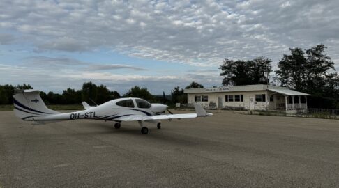
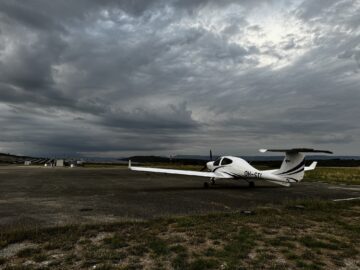
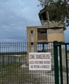
The airspace of southern France is full of restricted this and dangerous that, so a bombproof VFR route (in case you don’t get permission for anything in the air) is quite a slalom. To save time I decided to leave the coast for inland before Béziers. I would have landed to admire the fortress of Carcassonne, but the airfield was closed to visitors for several days because of an air show. I stopped at a couple of remote countryside airfields (LFMS and LFHO), where time seemed to have stood still.
France has a lot of airfields, but many of them are either for local aircraft only (“reserved for based aircraft”) or “RTF in FR only” (radio in French only), which as I understand it rules me out of operating there. In the Czech Republic, for example, it can easily happen that nobody in the air or on the ground (“Radio”) speaks English, but that isn’t written down anywhere, so you are allowed to go.
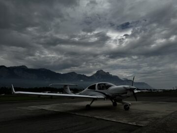
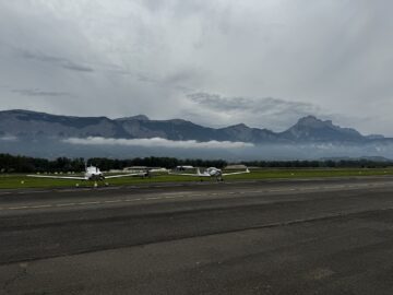
Grenoble Le Versoud (LFLG), France. Here, for the first time, it looks as if the big rocks are really getting closer. A magical thin veil hangs over the valley. Kerosene from a self-service pump, a decent lunch at the edge of the apron and a chat with a German biplane pilot. A nice atmosphere. There is even a tower (TWR) here, but landing cost only €12.50. At this point we agreed that another MIK pilot would join me in Milan about a week later.
Customs out, customs in
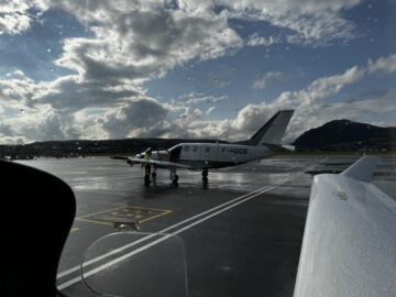
Annecy Haute-Savoie Mont Blanc (LFLP), France. A TBM 700 has just pulled up next to me. The rain that has gone on for a whole day finally eases, just in time for my customs slot out of the EU. That needed no less than 24 hours’ advance notice (PNR, prior notice required). Are they flying the customs officers in from Paris? Otherwise Annecy is a straightforward controlled IFR airfield, with parking very close to the terminal.
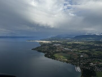
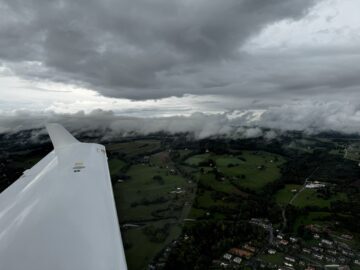
Lake Geneva. On its right shore you can see Thonon-les-Bains, France, and on the left shore already the promised land of my pilgrimage, Switzerland. That shore is also where my next destination is, Lausanne.
Lausanne (LSGL) is hidden somewhere among the FEW (few clouds) puffs on the slope in the middle of the picture, with the town within walking distance below it.
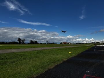
At last on Swiss soil. One hour’s PNR was enough for customs. I stay the night, because the very first valley is blocked. The 800-metre runway is cheerfully on a slope and has a dip in it, but it isn’t so steep that the wind doesn’t matter: I landed downhill. In the photo, a Pilatus PC-12 on the Finnish register, operated under a Finnish AOC (air operator certificate), is taking off. It flies charters and has Lausanne as its home base.
Into the Rhône valley
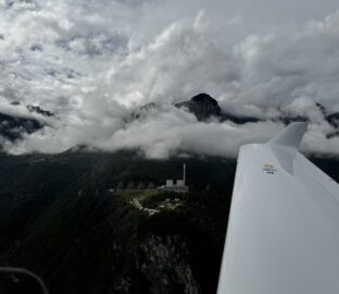
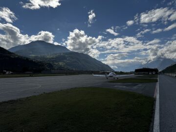
The Chavalon power station in Vouvry, in the Rhône valley, south of Montreux. The chimney is 120 m tall.
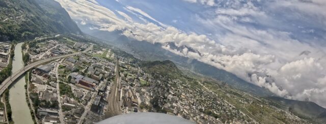
Cleared to land 25. Sion (LSGS). I’m just crossing the Rhône, which rises from the glacier of the same name not far from here and flows more than 800 km through Geneva, Lyon and Avignon to the Mediterranean.
There’s no rush hour on the GA apron at Sion: I’m the only one. The air is busy, though: helicopters, military aviation, turboprops and business jets, all operating from different aprons. On the right, jerry cans for water-contaminated fuel. It’s a walk of several hundred metres in a hi-vis vest to the terminal, though a free lift may turn up. A roomy restaurant terrace, with a proper rumble when a business jet departs from 25.
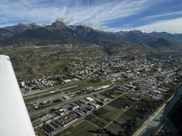
Take-off from runway 25 at Sion, left turn, now downwind, next report Z1 and a free climb in the TMA (terminal control area), heading for the Gemmi Pass, where the recommended minimum is 9,200 ft. It’s one of the passes that lead out of the valley to the north. Coming back to Sion is especially enjoyable through one of the closer passes (Sanetsch or Rawil), in the background of the photo. A flight plan (FPL) isn’t required. You only get radio contact at the ridge, and from there it’s laterally only 7 or 11 NM straight to the airfield, but 7–8,000 ft down, so it’s quite a dash down the slope.
Lovely PPR airfields in the embrace of the Alps
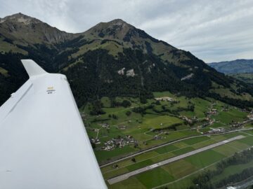
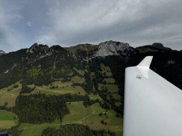
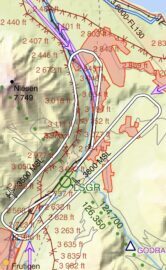
Reichenbach (LSGR). Downwind, runway 21, 3,800 ft. And the view to the right from the same spot. At the end of the downwind leg the terrain is still at 3,300–3,400 ft; the airfield is at 2,372 ft.
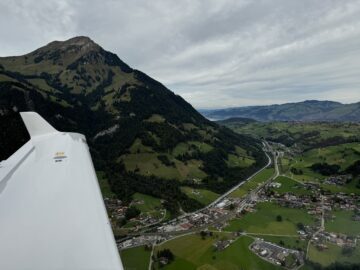
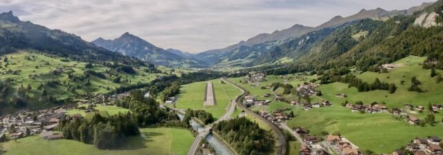
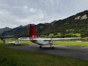
So you skim along the slope on the right as you turn final, and then go briskly downhill, with 705 m available for landing. Lake Thun shimmers in the background. The Caravan dropped a load of skydivers as soon as I was on the ground. Reichenbach is private and needs prior permission (PPR, prior permission required), online. All the information is in German only. I got permission straight away. Only one landing and take-off per day, and no take-offs at lunchtime, which is typical in Switzerland. The landing fee goes in cash in an envelope in a box, by bank transfer or with the Swiss Twint app.
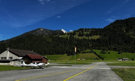
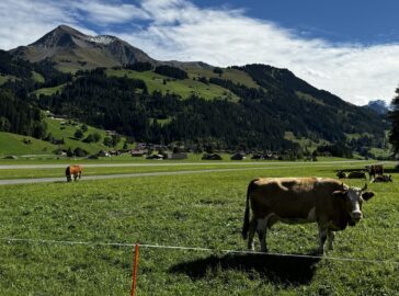
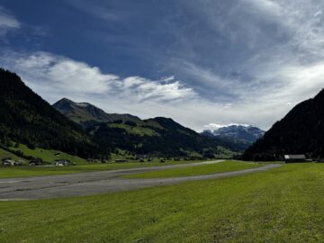
Another absolutely fantastic airfield, St. Stephan (LSTS). Private, owned by a factory, PPR 1 h (by phone), and lunchtime is sacred here too. No other aircraft. P.S. The airfield’s website has great videos of the approaches.
Mooo… we cows can fly ourselves, too! The runway is behind.
This is how every airfield should look: it puts your mind at rest. The terrain in that direction (runway 14) rises more steeply than a DA40 can climb, but behind the first ridge, on the right, there’s room to circle and climb. You need to gain at least 6,000 ft in 7 miles.
Take My Breath Away
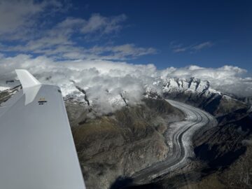
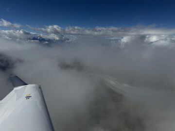
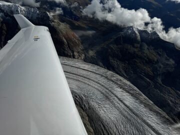
That highway practically tempts you to find out where it comes from. A steep climb.
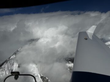
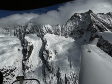
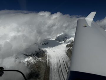
The Top Gun soundtrack playing in my Bose headset. 😎 Somewhere around here, the aircraft’s hardback manual flew out of the seat pocket behind me and into my lap. Luckily everything else was well secured, especially my seat belt. 😅
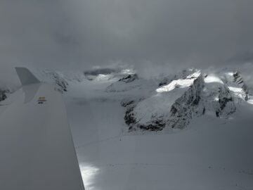
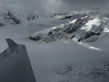
Konkordiaplatz, where the ice streams of the largest glacier in the Alps (the Aletsch Glacier) meet. The ice and snow surface is at about 9,000 ft. Many of the surrounding mountains are four-thousanders (Jungfrau, Mönch, Eiger, Finsteraarhorn and many more), 13–14,000 ft. My altitude here was about 11,000 ft. The terrain below me is very unforgiving, so I kept a close eye on how the Austro engine was doing. 🧐
I had hoped to fly around the Matterhorn up close as well, and did get fairly near at 13,000 ft, but it seemed to be guarded by thick masses of cloud. I had also planned a visit to the beautiful PPR airfield at Ambrì, but the Leventina valley seems to be covered by low cloud particularly often. This time Ambrì was closed by NOTAM (notice to airmen) for a few days anyway, so I didn’t even have to try.
Through the grey rock
In Switzerland and Austria the main valley routes have their own GAFOR weather forecasts (general aviation forecasts). One is issued 3 times a day for the next 6 hours, split into 2-hour periods, each of which is O (Open), D (Difficult), M (Marginal) or X (Closed). Really handy. When I got back to the Rhône valley from my previous day’s adventures, the forecasts looked very much like every route would be nothing but X the next day. So I parked STL in Sion, took a taxi 3,000 ft higher up to Nendaz, a well-known ski resort still waiting for snow, and parked myself in a nice spa hotel for 2 nights. From the edge of the village I could see the airport and STL, until the valley was shrouded in cloud and rain.
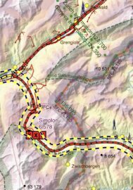
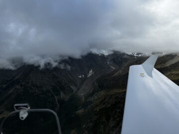
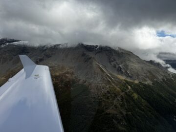
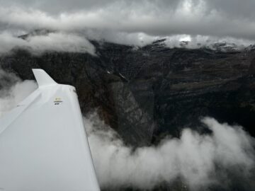
After a day of doing nothing, I got myself to the “Pilot Room” in Sion first thing in the morning to stand by, because today I had to get through the toughest line of defence in the Alps: the Simplon Pass, GAFOR route S44, reference altitude 6,800 ft, recommended minimum 8,300 ft. In the photos my altitude is just under 8,500 ft, and the forecast for that moment was D, which was fairly accurate, since in D the cloud base limit is 1,500 ft AGL (above ground level). The pressure difference was quite small and no descending air was expected, so the minimum was perfectly fine.
In the shade of the palms
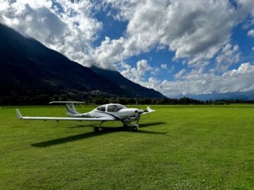
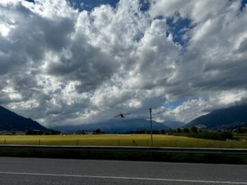
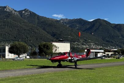
Locarno (LSZL), Switzerland. Behind me even the runway is grass, but the airfield also has a paved runway, which is where I landed. At the edge of the apron there’s a superb restaurant terrace with a wine list, and the best pizza I’d had in ages. If only that paid off at Finnish airfields too! I walked to the railway station and zipped into town for the night. A charming town on the shore of Lago Maggiore. Palm trees, Switzerland has palm trees! 🌴
Locarno airfield is also used by the military. In the middle photo, a Swiss Air Force Pilatus Porter is doing a touch-and-go.
In the Locarno briefing room I happened to run into a Finn who invited me along for a ride in their DA62, but I had already booked customs at Milan Bresso (PNR 12 h). So off I went. At Locarno, on the other hand, no PNR is needed for customs out of Switzerland; a flight plan is enough.
I arrived at Milan Bresso (LIMB) as planned and welcomed the second MIK pilot to the STL crew! Apparently because it’s so close to the centre of Milan (~10 km), this airfield is PNR (online) too, 3 h before any operation.
Just before the new pilot arrived, black cars of the Guardia di Finanza with flashing blue lights drove onto the apron. Soldiers or bodyguards kept a close eye on me hanging around, and soon the agency’s own medium helicopter (AW169) landed 100 metres from STL. Someone in a suit was escorted to a car, and the convoy left.
Part 2 of the travel report, covering our trip from Milan to Nummela, is on its way.
A bit of logistics
Airfield fees: LELL €54 (2 nights), LFMS 0 (0 nights), LFHO 0 (1 night), LFLG €13 (0 nights), LFLP €46 (1 night, customs), LSGL CHF 63 (1 night, customs), LSGS CHF 82 (2 landings, 3 nights), LSGR CHF 35 (0 nights), LSTS 0 (0 nights), LSZL CHF 42 (1 night, customs), LIMB €19 (0 nights, customs). As you can guess from the prices, none of them has mandatory handling. Otherwise prices in Switzerland, for hotels and restaurants for example, are high, tens of percent more than in Finland.
International taxi apps often don’t work in France, Switzerland and Italy, at least not in the countryside or small towns. Finding local taxis takes time. It’s worth trying to sort that out in advance if you can be bothered. Airfields within walking distance of a village or a station are excellent.
The many PNRs and PPRs (on top of the usual mandatory flight plans for border crossings) make travelling a little awkward, but in Switzerland especially you can’t really avoid them. It pays to know about all of them in advance, so there are no surprises in the schedule.
…